sciences de la vie et de la Terre
 s'identifier
 portail personnel ETNA
espace pédagogique > disciplines du second degré > svt > enseignement > ressources pédagogiques
biodiversity in the Loire estuary
mis à jour le 28/06/2023

Virtual trip to Port Lavigne in Bouguenais to explore diversity of animals and plants.
mots clés : biodiversity, estuary, Loire, sand, water, mud

Aerial view from "Le Port Lavigne" (author : Bénédicte
Cordellier)
Lycée Jean Perrin, Rézé, France
|
|
AN EXTRACT FROM THE IGN MAP ( SCALE 1/25,000 )

Copyright IGN www.ign.fr/
On this extract from the IGN map ( scale : 1/25,000 ), the main stopping places of the trip are indicated by yellow squares. Click on the squares to see pictures of the areas. You can also turn to the Aerial picture to spot the test sites.
LOCALISATION OF THE TEST SITES

Copyright IGN www.ign.fr/
On this aerial photograph, the test sites are indicated by yellow squares. Click on them and you will see some pictures of the fauna and the flora. This can also be achieved on an extract from a map (scale : 1/25,000).
| Back to the Aerial View
|

|
|
The damp meadow grows on very clayey, soaked soil. The characteristic plants to be found there are the reed canary-grass, Baldingera ( phalaris) arundinacea , rushes, Juncus sp. , and buttercups, Ranunculus sp.. The meadow is lined with ashtrees, Fraxinus oxyphyllus, and may be grazed but is seldom mown. It gets soaked by the spring tides and many ponds are thus left behind where aquatic insects and frogs can live.
 |
Rush. This juncaceae grows in very damp places. |
| Buttercups won't thrive on frequently mown areas. Therefore they grow more densely in meadows that are never reaped. |  |
 |
A line of ashtrees along the damp meadow. |
|
Ashtrees are often trimmed by farmers so as to become pollards. These fast-growing trees adapt to soaked areas together with various species of willows and form hedges along the ditches. Numerous birds nest in ashtrees . The ashtree is a colonial tree. |
 |
 |
The composed leaves of the ashtree as well as its fruit can easily be identified. The fruit scattered away by the winds ensure the spreading of the ashtree as the seeds sprout amid the bushes. Thus, the ashtree is one of the first species to settle in ruins and wasteland. |
| The ponds and ditches are usually filled with freshwater where aquatic insects swarm during the spring. Frogs and toads also lay their eggs there. In the photo, a frog is resting on a twig of reed-grass. |  |
|

|


LE PORT LAVIGNE
| Back to the Aerial View |
 |
Located on a once important branch of the Loire, le Port Lavigne used to be a rocky islet that clearly emerged from the alluvial plain. There, ships from America would unload their goods : the quay and the remains of the warehouses are the last evidence of that activity . Indeed, the silting of the river has made it impossible for ships with great draught to navigate. Only the shallow boats of amateur or occupational fishermen are allowed today.
| The Port Lavigne branch hardly lives on nowadays. Major harbour development policies have been carried out so as to cut off all the secondary branches by dyking them up or filling them in. The mud clog then moved landward and caused a considerable silting up of the river. A sluice has recently been built upstream so as to keep what remains of the channel from the salty and muddy streams of flowing tide. |  |
 |
Right in the middle of the main branch of the Loire, the massive amphibolite platform of Port Lavigne provides a solid foundation for the houses and the ancient warehouses and protects them from great floods. |
| Since the achievement of considerable improvement works in the harbour, the water level in Nantes has gone by several metres down to sea level. Back in the nineteenth century, the islets and the sands banks scattered along the middle estuary impeded the flow to the ocean and so allowed greater floods to reach the bases of the houses in Port Lavigne. |  |
 |
Evidence of the past harbour activity, this stone-paved quay or slipway allowed small boats to run aground and open sea ships to unload thanks to long foot-bridges or lighters. |
| Nowadays, the harbour activity has come down to smaller fishing carried out by amateur fishermen, retired or unemployed people. These small traditional boats are equipped with square fishing nets to catch flatfish and white-fleshed fish that live on the muddy bottom of the cutoff branches. Back |  |
THE REEDY MARSH AND THE WILLOW WOODS GROW ALONG THE SILTED CHANNELS.
| Back to the Aerial View |

|
 |
During high tide slack, a thick layer of watery " creamy mud " deposits. Most of it will drain off as the the water retires but what remains will mix with the slime from the diatoms and will help the formation of mud patches. |
| Diatoms
are unicellular algae which grow and divide thanks to photosynthesis. As
primary producers, they're at the root of the estuarine trophic web. They
produce a sticky mucus that traps and agglutinates the clay particles of
the mud. Little by little, the mud become solid and erosion -proof and can
then be colonized by other plants.
|
 |
 |
The reed marsh settles on top of the mud patches. |
| The common reed is a tall graminae that can grow on soaked, little oxygenated soil . As colonial plants, they form dense settlements called reed marshes. These marshes used to be exploited , to yield building material as well as litter and were called "rouches " . Numerous species of passerines and small mammals live in the reed marsh. |  |
 |
Once colonized by the reeds, the mud is solid enough to allow willowtrees to grow. Not far away from the water, they form dense, screen-like settlements also known as " ripisylve " - etymologically " woods of the riverbanks " . |
| There are many
species of willows, among which the common osier whose golden yellow branches
were once used for wicker work or to make ties for the vine and cooperage
too.
|
 |
THE SECONDARY BRANCHES OF THE LOIRE
| Back to the Aerial View |

|
The secondary branches flood during high tide and cease to be navigable, owing to very fast silting. Yet, they shelter many species of fish and birds which can no longer find suitable living conditions in the main branch. The flow also decreases since plants such as diatomes, reeds - Phragmites communis, and willows - Salix sp., grow on the mud and stabilize the bed of the channel.
| Depending on the tide in the estuary, the depth of the secondary branches varies quite a lot and the water completely drains off when the tide is low,thus allowing mud flats to show up. |  |
 |
Square net fishing is a traditional activity among the riverside people who catch flatfish and white-fleshed fish. Square net fishing is both a leisure and a source of income for amateur fishermen, retired or unemployed people. |
| Usually built on a small pier, the square fishing net shack - made of junkyard reject- is often ugly. Fortunately, you may exceptionally come across some nicer-looking ones. |  |
 |
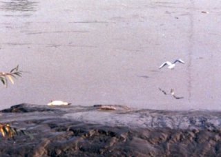
Mews - Larus ridibundus, feed on small crustaceans and shrimps that swarm in the river according to the season, shells and even fish. Limicolous ( = that live on the mud ) waders forage for worms and insect larvae that live on the mud flats. |
| Once filled with mud, the secondary branches are reduced to slightly depressed areas overgrown by reeds and reed weed-grass and crossed by narrow channels. |  |
| Back to the Aerial View |

|
Toward the end of the nineteenth
century, silt accumulated against an embankment, thus
forming the island of "La Fourche". About 50 years ago , sand started settling
on the island, owing to the dredging of the river, necessary
for navigation. The surface of the sand has progressively been overgrown by
drought- resistant plants such as sedum, bedstraw
-Galium arenarium, field eryngo - Eryngium
campestre, etc
which constitute the xerophitic
lawn. The wild rose- Rosa canina, and the bramble
- Rubus fructitosus, have progressively grown into thickets in the dampest
areas of the meadow. Rabbits have dug their warren
into the soft soil.
 |
The dredging of the river consisted in pumping in silt -laden water through pipes; the water was then pumped out directly onto the bank . Today, the pipes are left to rust as the artificial dune provides habitat for plants and animals.
|
| Strata similar to those present in sedimentary rock(s) can be observed. One may notice too that the layer of vegetal ground is only about 2cm thick. That is the result of the accumulation of vegetal remains on the surface of the sand. On this thin layer of ground particularly dry during the summertime, only drought resistant plants specially adapted to these conditions can survive. |  |
 |
The sometimes patchy xerophitic lawn grows on the sand.There, one may find sedums, bedstraw and field eryngo. |
| The bedstraw has very long roots (more than 2 metres long) that enable it to reach water deep down into the ground. |  |
 |
The sedum has very thick,cylindrical leaves that can stock water. |
| The field eryngo , like several other dry-area plants, has shiny, prickly leaves that drive herbivores away. After scattering numerous seeds, itsaerial parts disappear into the ground at the end of the summertime while the underground parts remain alive , which is another type of adaptation to drought conditions. |  |
 |
As for the thorny wild rose, it constitutes the second wave of colonial plants. Trees and shrubs keep a moist underbrush that will allow their seeds to sprout . Until then, many passerine birds also build their nest there. |
| This rabbit hole is one of the many that constitute a warren, that is a network of burrows dug out by a population of rabbits. |  |
 |
On the embankments once built to canalize the river so that the bottom of the Loire may remain hollow rather than silt up, tall aspens and white poplars- Populus alba, have been planted . Those which managed to overcome the effects of salt and the sliding down of the banks have reached unusual old age among that species. back |
| Back to the Aerial View |
 |
The reed sweet-grass, Glyceria
Maxima, forms dense settlements in the most frequently flooded areas.
In this picture, the plants have been flattened by spring tide flooding
that allowed a 5- centimetre- thick mud layer to settle
on them. Whithin a few weeks, this mud will be regained by the vegetals
of the meadow. In the meantime, mammals and birds
leave their footprints on the ground.
 |
Glyceria Maxima is a very productive grass that grows on soaked meadows together with bur weed, Sparganium sp. , and Yellow Flags, Iris pseudacorus. |
| During high tide slack, the clay particles carried away by the river stream, floculate and settle down on the bottom of the estuary. Most of that mud will suspend again in the water as the next tide comes. Indeed, one million tons or so of sediment gets constantly stirred up. During the spring high tide slack, the mud forms patches of deposit on the lower meadows by the riverside. |
 |
 |
On the soft mud, the footprints of a nutria / coypu, Myocastor coypus, ( left ) and of an amphibian vole , Arvicola sapidus, ( right ) testify for the presence of numerous rodents. These animals feed on the meadow plants. |
| A wandering fox,Vulpes vulpes, has left behind characteristic footprints.
|
 |
| Back to the Aerial View |

|
The main branch of the Loire is nowadays the only active one and is not more than a few hundred metres wide at the most. It has been thoroughly embanked and dredged (excavated) by the Port Autonome and is navigable to 6 -metre- draught boats. The tidal currents are so strong there that they contribute to bank erosion whereas the operation of silt impedes the flow of the river. Yet, the river remains a compulsory passage way to migratory fish such as elvers, salmons, shads and mullets. These fish are caught by occupational as well as amateur fishermen, but unfortunately by poachers too.


François Cordellier, professeur de SVT au lycée Jean Perrin de Rezé
information(s) pédagogique(s)
niveau : Lycée tous niveaux, Collèges tous niveaux
type pédagogique : sortie pédagogique, activité de découverte
public visé : enseignant, élève
contexte d'usage : atelier, classe, espace documentaire, laboratoire, salle multimedia, sortie pédagogique
référence aux programmes : Education pour un développement durable
Diversité et complémentarité des métabolismes
La biodiversité, résultat et étape de l'évolution
sciences de la vie et de la Terre - Rectorat de l'Académie de Nantes